LeBreton Flats Summer Orienteering
August 3rd 2021 6:00pm - 8:00pm
Map: LeBreton Flats
Continuing with our theme of new maps, this week we have another one for you at LeBreton!
Start/finish is at Pindigen Park. There is some free street parking on the streets around the condo complex and more paid parking at the War Museum across the road. Or you can take the LRT to Pimisi station nearby.
This course features lots of complex route choices and navigation. The terrain is 100% urban and parkland, shorts and running shoes are recommended.
- Short: 1.8 km, 20 controls
- Long: 2.5 km, 25 controls
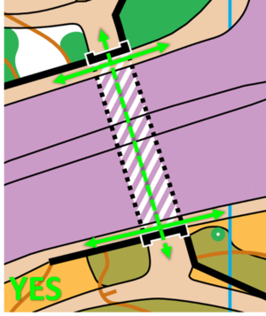
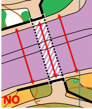
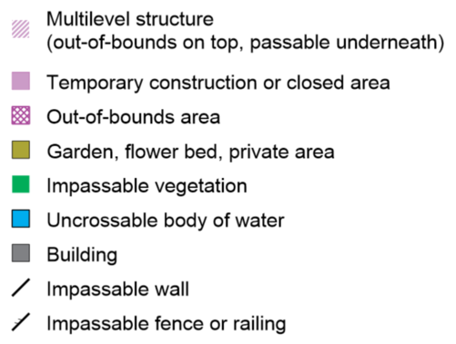
Wellington St. and Portage Bridge are out of bounds (purple on the map), that means during the course are not allowed to cross over top of them. You can however pass through the tunnels underneath. This map has a new symbol for multilevel structures (2 or more surfaces above one another). White hatch on the map. Tunnels are mapped using this symbol.
Here is an example of where you can and cannot run.
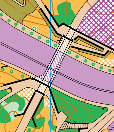
If that isn’t complicated enough for you, there is an area on the map where there are two tunnels stacked on top of one another that go under a road. It is mapped like this.
See you on Tuesday,
Robbie Graham, Course setter | Jeff Teutsch, Controller