Chapel Hill Do Not Use
May 29th 2022 10:00am - 2:00pm
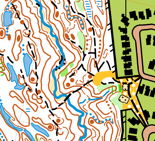
Map: Chapel Hill
Meet director/Controller Andrew Cornett, Cathy Bakker
Yes, Andrew has another meet for us to enjoy at 6160 Orléans Boulevard. Some of you may recall having run here in 2019 for the OFest middle distance eventin the outdoor sauna that day!
The terrain features several wooded ravines within a suburban neighbourhood (Chapel Hill). The ravines are bordered by a complex collection of ridges, gullies, knolls, depressions, marshes and ponds, where tracking your location with care is advised! Note that the gullies, ponds and marshes are currently a bit larger/wetter than mapped. There are very few rock features, however, steep earth banks have been mapped using the passable cliff symbol without tags. The mature woods are generally wide open and offer good visibility and runnability. A few scattered trees were felled by last weekend's storm, but the damage is quite minor and should not affect safety or interfere with the orienteering. There is a dense trail network in some areas, and I have spent a full day adding some of the new and less distinct trails to the map. However, do not be surprised to encounter unmapped indistinct trails and animal tracks.
The usual four courses will be waiting for you to explore:
- Novice, 2.5km, 16 controls
- Intermediate, 3.5km, 12 controls
- Short Advanced, 4.5km, 16 controls
- Long Advanced, 6.7km, 22 controls
Maps for all courses will be printed at 1/7500 scale with 5m contours.
The start and finish for all courses will be at Heritage Park, 6160 Orléans Blvd, where parking is available.