Chapel Hill B-meet Our Sunday Events
April 26th 2026 10:00am - 2:00pm
Map: Chapel Hill
Something lurks below the sprawl of suburbia. Neighbourhoods cleaved in twain by ravines, lakes and hills just beyond one's door. So near to civilization yet so far from tamed. The intersection of the known and the unknown. The forests of Chapel Hill beckon to be explored.
Arena: Registration, start, and finish are in Heritage Park off Orléan's Blvd.
Courses: We are offering 5 courses this weekend.
Novice: 1.8 km, 60 m climb, 10 controlsIntermediate: 3.0 km, 90 m climb, 10 controls
Short Advanced: 2.9 km, 100 m climb, 11 controls
Medium Advanced: 5.2 km, 210 m climb, 21 controls
Long Advanced: 7.0 km, 275 m climb, 27 controls
- Many trails are covered with leaves and may be difficult to follow. Novice and Intermediate runners be aware.
- The Medium and Long Advanced courses have 1 water control 50% through their course.
- The Medium and Long Advanced courses have lots of legs that cross over each other to make use of the small area, double check the sequence number to be sure you're going to the right control.
- The convent at the north end of the map, previously out of bounds, was recently acquired by the City of Ottawa and thus is now available for us to run through. It offers a nice connection between the east and west portions of the map. The Medium and Long Advanced courses will briefly explore this new area.
Terrain
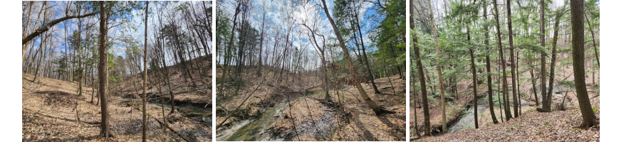
Beyond the crescented streets of the Chapel Hill neighborhood you'll find forested plateaus with subtle yet detailed areas of linear ridges and troughs. The low parts have been filled with water to form long ponds and marshes. These flatlands are split by steep-walled ravines with streams and ditches running up the sides. An extensive trail network covers the whole map. The trees have not yet budded so the woods are exceptionally open.
Hazards
- Some ravines have deep water and many are very slippery due to their clay beds.
- Intermediate and all Advanced courses cross Forest Valley Dr which can be busy.
- This area is popular with dog walkers and dogs are allowed off-leash in the forests and parks.
- Be sure to check yourself thoroughly for ticks after your race.
Livelox
We are testing out Livelox, an alternative route analysis website to RouteGadget. Livelox has many cool features that you can use to compare your routes with others to see where you navigated well and where you can improve. Please upload your routes after you've finished your race! The event is available at this link and will go live on Sunday morning. There will also be a QR code printed directly on your map. https://www.livelox.com/
We hope to see you out,
Robbie and Marketa Graham
Our Sunday Events
Will this be the first time at one of our meets for the year? We will need contact information and signing of a waiver. By providing your personal information here in advance of the event, we can include you in our on-site database, give you a better chance to read the waiver before online acceptance, make the registration process faster for you and speed up registration for all. There is no charge at this point - the final registration and payment will be on-site on the day of the event. This must be done 48 hours before the event to ensure time to get it uploaded to the on-site database.
Recycle your map bag Drop your clean map bag into the recycle box below the download.
Meeting Point: The map below indicates only the general area of the event. In the week before the event, the map will be adjusted to display the exact details of our meeting point and other meet specifics will be posted.
Finish: Courses close and controls are collected at 2pm. All participants must report to finish by 2pm.
Safety and Ethics: We encourage you to read our Safety and Ethics page to ensure a safe and enjoyable run.
Timing : These may differ for some events. Most days wiil be:
- Registration: 10am - 11:00am (Registration closes at 11:00 so the volunteer registrars can get out on course!) - It may be different for some events -
- Starts: 10:30 - 11:30
We run rain or shine but if you have any doubts check this site for last minute changes.
New at orienteering or a bit rusty? Think you may need a quick review of map reading or some help with route planning? Join us at 10:30 for a 15 minute Mini Intro to Orienteering clinic.. We ask that you arrive early enough to register for the event first so you have a map in-hand. The instructor will cover the event type, general procedures (SI stick, Clear and Check, finish process etc), safety information and basic map reading/navigation pointers. Look for the sign near the registration table and we'll see you there.
Water: Please bring your own water bottles. We will provide water, but limit the use of disposable cups. Please have your water bottles at the finish.
As always, make sure you do a careful tick check when you get back.
The following day visit our Route Gadget page to enter the route you took and compare to others or just have a look at how others tackled the course. -- a great learning tool.